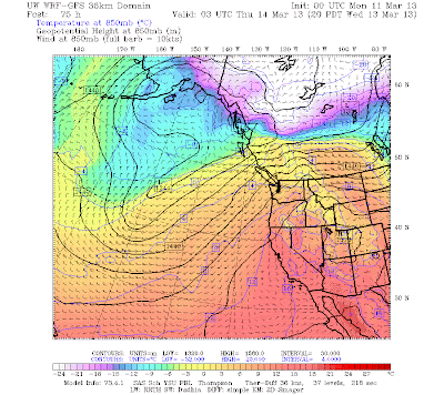
So today, this blog will begin leveling the playing field by announcing that Atmospheric River Poseidon will soon hit our coast, bringing torrential rains and possibly flooding to some rivers drainages.
Be advised. Poseidon is approaching!
Poseidon arrives on Tuesday. The WRF model prediction of the total water vapor in an atmospheric column for 1 PM that day shows the watery "finger" of Poseidon stretching from near Hawaii to the Northwest. Yes, some folks have called this a "Pineapple Express", but we are beyond that now.
Poseidon's humid, warm finger will be touching us for days! Let's look at the forecast precipitation for several 24-h periods. The first, ending 4 PM on Tuesday (see graphic), shows the intensification of the precipitation as it is forced to rise by the local terrain, with the main impacts being in southern B.C. and NW Washington. 2-5 inches will pummel the windward side of Vancouver Island.
But Poseidon is not finished with us! The next 24-h (ending 4 PM on Wednesday) enhances the terrible wrath, as his briny, wet finger strengthens and drifts down across Washington (see graphic). The western side of the Olympics will be particularly hard hit, as will the central Cascades.
And the final 24-h period I will show you (ending at 4 PM on Thursday), shows Poseidon's watery revenge moving a bit northward.
To get the whole wet picture, here is the 72hr precipitation total ending 4 PM on Thursday. 5-10 inches over the Olympics, north Cascades, and mountains of southern B.C. Enough to bring some rivers to near bankfull. (The National Weather Service has a hydrological outlook that notes the potential threat). The interesting thing is that from Portland southward it will be dry...and quite warm. This time the Willamette will be favored by the trident-clad one.
For the middle of March, this will be a notable event, worthy of a proper name. Too far away for the Weather Channel's attention or even a visit by Jim Cantore. But we will honor it, in our fashion.


0 nhận xét:
Đăng nhận xét