
During the 1970s, work by Professor Peter Hobbs and colleagues (at the UW!) explored offshore fronts with aircraft and coastal (research) radars. They found that many fronts, and particularly the strong ones, were not unbroken lines of precipitation, temperature change, and wind shift; rather, the fronts were often corrugated, with areas of heavy precipitation (and large changes in temperature and wind) separated by gap areas, where changes were much more gradual. Sunday's front had these characteristics: let me show you.
Here are two radar images at 9:20 and 10:20 AM on Sunday morning. The front is offshore and heaviest precipitation with the front is denoted by red. Can you see the corrugation and the core/gap areas?
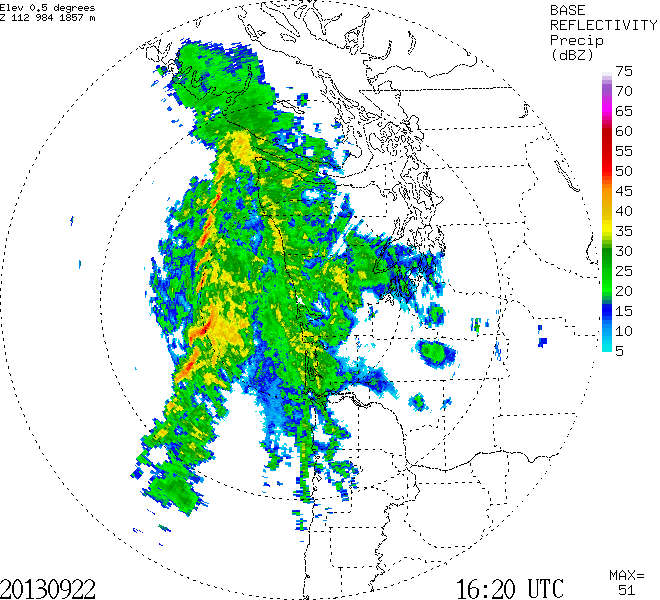

Here is a blow up at 10:08 AM of a core/gap combo:

During the 90s we have field experiment called COAST in which we flew the NOAA P3 Hurricane Hunter aircraft into a Pacific front. The scientists wanted to go out and cross one of the cores to see what it was like. The NOAA P3 pilots agreed...they had been through many hurricanes, so they were not concerned. Well, the passage through the core at around 2000 ft was very, very intense--with several g's up and down and the coffee pot broke off in the rear of the aircraft and life rafts pulled out from under the seats. Several scientists thought they were going to die. The pilots were shaken...no more flights through cores at low levels--this was a lot worse than going through hurricane eye walls. The return was at 5,000 ft through a gap...no problem.
Why the cores and gaps? It is thought to be due to some kind of wavelike instability forced by the large wind shears along strong fronts.
To get an idea how strong Sunday's front was, here is a graph of sustained winds, gusts, and pressure at Destruction Island, just off the central Washington coast. Time increases to the right. Look in the middle of the graph for the right time. Wind gusts him 45 knots, around 52 mph. The pressure shows a very sharp dip...the lowest pressures are associated with the front.

Reading the Northwest Sky
I am giving a five-lecture evening short course: "Reading the Northwest Sky: Understanding Our Weather and Climate"
October 1, October 22, November 5, November 26, December 3
Kane Hall: University of Washington
Co-Presented by University of Washington Alumni Association and Seattle Public Lectures.
If anyone is interested, more information here.


0 nhận xét:
Đăng nhận xét